

Tap Tap to Zoom
Product No Longer Available
Unfortunately Garmin On The Water GPS Cartography BlueChart g2 Vision: UK & Ireland Small North Map is not listed by CampSaver.You can also explore other items in the Camp & Hike, Fishing, Boating & Marine, Camping Essentials, Electronics & Power, Fishing Marine Electronics, GPS yourself to try and find the perfect replacement for you!
Product Info for Garmin On The Water GPS Cartography BlueChart g2 Vision: UK & Ireland Small North Map
The Garmin On The Water GPS Cartography BlueChart g2 Vision: UK & Ireland Small North Map sold by us is an 100% Genuine Garmin GPS Accessories product that comes with a Garmin manufacturer's warranty. Garmin On The Water GPS Cartography BlueChart g2 Vision: UK & Ireland Small North Map will fulfill all of your specific needs as Garmin products are trusted and considered to be the best GPS navigation systems all around the world. Buying a Garmin On The Water GPS Cartography BlueChart g2 Vision: UK & Ireland Small North Map from us means getting the best price and purchasing from a trusted source - we're an Authorized Garmin Dealer for all Garmin as well as running and cycling GPS, GPS, radios, and hundreds of Garmin GPS Accessories, software and maps.![]()
| Name | Description | Garmin Blue Chart g2 Vision on SD Card |
|---|---|---|
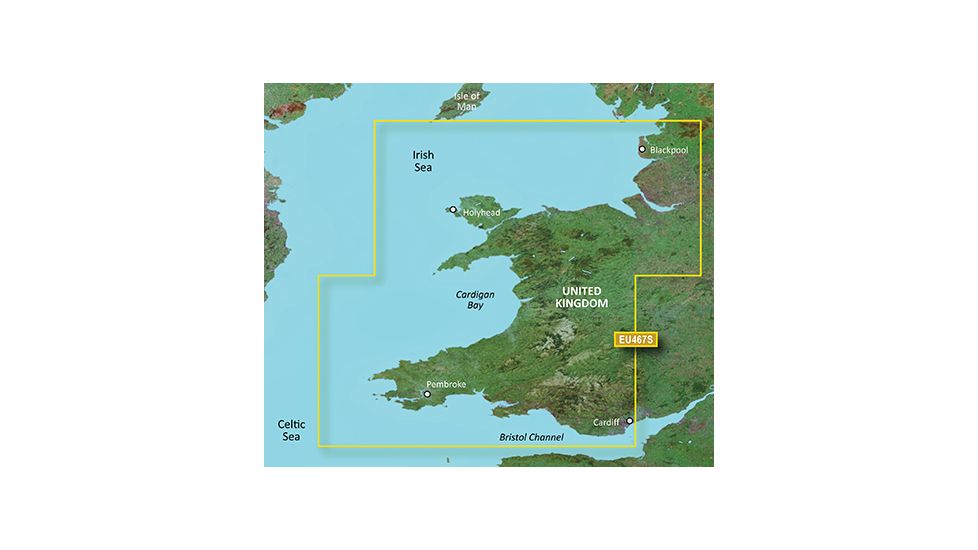
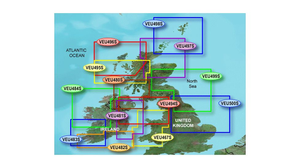
| Garmin Map - Blackpool to Cardiff, Jul 08 (VEU467S) | Detailed coverage from Cardiff to Blackpool including Cardigan Bay, the northern portion of Bristol Channel, Holyhead, and Liverpool. | Garmin 010-C0811-00 |
| Garmin Map - Ross of Mull to Killough, Jul 08 (VEU480S) | Detailed coverage of the coast of Northern Ireland from Newcastle to Malin and of Great Britain from Ross of Mull to Stranraer. Also includes detailed coverage of Belfast and Portrush, Northern Ireland, as well as the North Channel. | Garmin 010-C0824-00 |
| Garmin Map - Belfast to Waterford, Jul 08 (VEU481S) | Detailed coverage from Belfast, Northern Ireland to Tramore, Ireland. Also includes detailed coverage of Dundalk, Dublin, Wicklow, Wexford, and Waterford. | Garmin 010-C0825-00 |
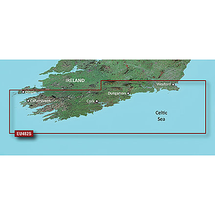
| Garmin Map - Wexford to Dingle Bay, Jul 08 (VEU482S) | Detailed coverage of Southern Ireland from Wexford to Ventry. Also includes detailed coverage of Dungarvan, Cork, and Cahersiveen. | Garmin 010-C0826-00 |
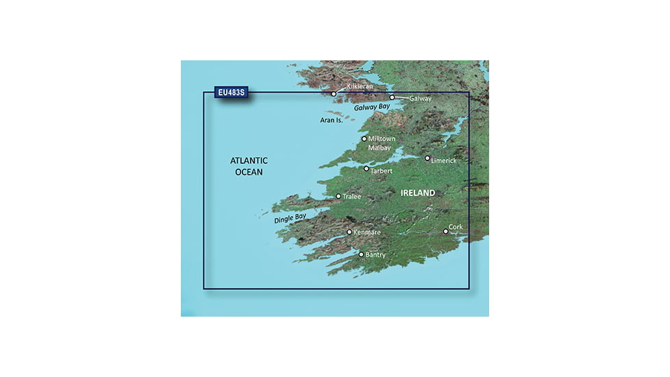
| Garmin Map - Galway Bay to Cork, Jul 08 (VEU483S) | Detailed coverage of Southwestern Ireland from Kilkieran to Cork. Also includes detailed coverage of Galway Bay, Tarbert, and Tralee. | Garmin 010-C0827-00 |
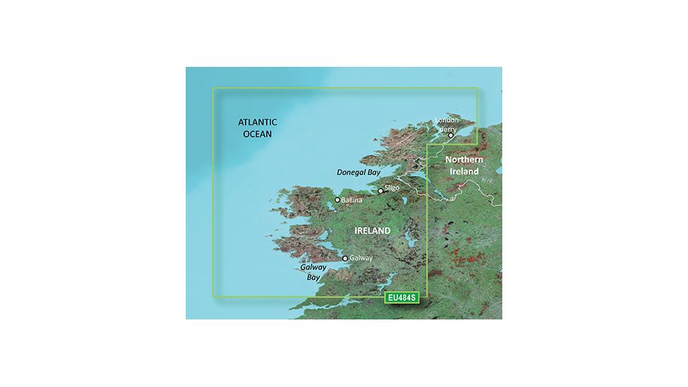
| Garmin Map - Ireland North-West, Jul 08 (VEU484S) | Detailed coverage of Northwestern Ireland from Londonderry to Galway Bay. Also includes detailed coverage of Sligo, Ballina, Galway, and Donegal Bay. | Garmin 010-C0828-00 |
| Garmin Map - Belfast to Liverpool, Jul 08 (VEU494S) | Detailed coverage of both sides of the Irish Sea from Belfast to Dublin, Ire. and from Carlisle to Liverpool, Great Britain. Includes detailed coverage of the Isle of Man. | Garmin 010-C0838-00 |
| Garmin Map - Loch Ewe to Mull, Jul 08 (VEU495S) | Detailed coverage of the southern half of the Outer Hebrides to Mull. Including detailed coverage of North and South Uist, Isle of Skye, and Island of Mull. Also includes detailed coverage of the Firth of Lorn and Loch Linnhe from Oban to Inverness. | Garmin 010-C0839-00 |
| Garmin Map - Outer Hebrides and Skye, Jul 08 (VEU496S) | Includes all of the Outer Hebrides with detailed coverage from the Isle of Lewis to Barra, including the Isle of Skye. Also includes detailed coverage of Northwest Highlands from Durness to Ardtoe, including Lochiniver, Ullapool, and Mallaig. | Garmin 010-C0840-00 |
| Garmin Map - Orkneys and Moray Firth, Jul 08 (VEU497S) | Includes detailed coverage of the Orkney Islands and Fair Isle. Also includes detailed coverage of Scottish Coast from Durness to Montrose, including Thurso, Wick, and Aberdeen. Detailed coverage of the Moray Firth to Inverness and Loch Ness to Fort Augustus. | Garmin 010-C0841-00 |
| Garmin Map - Shetlands and Orkneys, Jul 08 (VEU498S) | Detailed coverage of all of the Shetland Islands, Fair Isle, and the Orkney Islands. Includes coverage of Thurso and Wick on the mainland. | Garmin 010-C0842-00 |
| Garmin Map - Aberdeen to Scarborough, Jul 08 (VEU499S) | Detailed coverage of the Scottish and English coast from Aberdeen to Scarborough, including the Firth of Tay, the Firth of Fourth, Edinburgh, Newcastle, and Middlesbrough. | Garmin 010-C0843-00 |
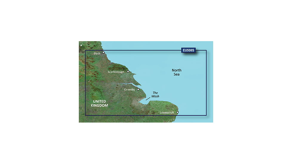
| Garmin Map - Blyth to Lowestoft, Jul 08 (VEU500S) | Detailed coverage of the English coast from Blyth to Lowestoft, including Newcastle, Middlesbrough, Kingston Upon Hull, The Wash, and Boston. Also includes coverage of the Humber River to Goole and the Trent River to Gainsborough. | Garmin 010-C0844-00 |
| Garmin BlueChart g2 Vision microSD/SD cards are compatible with the following units: | ||
| GPSMAP 525/535/545/555 | GPSMAP 420/430/440 GPSMAP 520/530/540 | |
| Limited Compatibility: | GPSMAP 4008/4010/4012 GPSMAP 4208/4210/4212 | |
| Colorado/Oregon | GPSMAP 5008/5012/5015 GPSMAP 5208/5212/5215 | |
Be the first to review this product
Garmin On The Water GPS Cartography BlueChart g2 Vision: UK & Ireland Small North Map Unavailable & Discontinued Models
List of Unorderable Models
- Garmin BlueChart g2 Galway Bay to Cork v2010.5-v12 microSD Card w/SD Adapter 010-C0827-20 , MPN: 010-C0827-20 , UPC: 753759092641 , Code: GA-X1-DEBFDA-010-C0827-20
- Garmin BlueChart g2 Ireland North West v2010.5-v12 microSD Card w/SD Adapter 010-C0828-20 , MPN: 010-C0828-20 , UPC: 753759092665 , Code: GA-X1-DEBFDA-010-C0828-20
- Garmin BlueChart g2 Blackpool to Cardiff v2010.5-v12 microSD Card w/SD Adapter 010-C0811-20 , MPN: 010-C0811-20 , UPC: 753759092405 , Code: GA-X1-DEBFDA-010-C0811-20
- Garmin BlueChart g2 Wexford to Dingle Bay v2010.5-v12 microSD Card w/SD Adapter 010-C0826-20 , MPN: 010-C0826-20 , UPC: 753759092627 , Code: GA-X1-DEBFDA-010-C0826-20
- Garmin BlueChart g2 Blyth to Lowestoft v2010.5-v12 microSD Card w/SD Adapter 010-C0844-20 , MPN: 010-C0844-20 , UPC: 753759092986 , Code: GA-X1-DEBFDA-010-C0844-20
- Garmin BlueChart g2 IrelandNorth-West GarminCard v2010.5-v12 010-C0828-10 , MPN: 010-C0828-10 , UPC: 753759092658 , Code: GA-X1-DEBFDA-010-C0828-10
- Garmin BlueChart g2 GalwayBaytoCork GarminCard v2010.5-v12 010-C0827-10 , MPN: 010-C0827-10 , UPC: 753759092634 , Code: GA-X1-DEBFDA-010-C0827-10
- Garmin BlueChart g2 BlackpooltoCardiff GarminCard v2010.5-v12 010-C0811-10 , MPN: 010-C0811-10 , UPC: 753759092399 , Code: GA-X1-DEBFDA-010-C0811-10
- Garmin BlueChart g2 WexfordtoDingleBay GarminCard v2010.5-v12 010-C0826-10 , MPN: 010-C0826-10 , UPC: 753759092610 , Code: GA-X1-DEBFDA-010-C0826-10
- Garmin BlueChart g2 BlythtoLowestoft GarminCard v2010.5-v12 010-C0844-10 , MPN: 010-C0844-10 , UPC: 753759092979 , Code: GA-X1-DEBFDA-010-C0844-10
- Garmin BlueChart g2 Vision - Ireland North-West JUL 08 (EU484S) SD Card 010-C0828-00 , MPN: 010-C0828-00 , UPC: 753759070083 , Code: GA-X1-DEBFDA-010-C0828-00
- Garmin BlueChart g2 Vision - Galway Bay to Cork JUL 08 (EU483S) SD Card 010-C0827-00 , MPN: 010-C0827-00 , UPC: 753759070076 , Code: GA-X1-DEBFDA-010-C0827-00
- Garmin BlueChart g2 Vision - Wexford to Dingle Bay JUL 08 (EU482S) SD Card 010-C0826-00 , MPN: 010-C0826-00 , UPC: 753759070069 , Code: GA-X1-DEBFDA-010-C0826-00
- Garmin BlueChart g2 Vision - Blackpool to Cardiff JUL 08 (EU467S) SD Card 010-C0811-00 , MPN: 010-C0811-00 , UPC: 753759069919 , Code: GA-X1-DEBFDA-010-C0811-00
- Garmin BlueChart g2 Vision - Blyth to Lowestoft JUL 08 (EU500S) SD Card 010-C0844-00 , MPN: 010-C0844-00 , UPC: 753759070243 , Code: GA-X1-DEBFDA-010-C0844-00
- Garmin BlueChart g2 Vision - Loch Ewe to Mull, JUL 08 (EU495S), SD Card , MPN: 010-C0839-00 , UPC: 753759070199 , Code: GA-X1-DEBFDA-010-C0839-00
- Garmin BlueChart g2 Vision - Belfast to Liverpool, JUL 08 (EU494S), SD Card , MPN: 010-C0838-00 , UPC: 753759070182 , Code: GA-X1-DEBFDA-010-C0838-00
- Garmin BlueChart g2 Vision - Shetlands and Orkneys, JUL 08 (EU498S), SD Card , MPN: 010-C0842-00 , UPC: 753759070229 , Code: GA-X1-DEBFDA-010-C0842-00
- Garmin BlueChart g2 Vision - Ross of Mull to Killough, JUL 08 (EU480S), SD Card , MPN: 010-C0824-00 , UPC: 753759070045 , Code: GA-X1-DEBFDA-010-C0824-00
- Garmin BlueChart g2 Vision - Belfast to Waterford, JUL 08 (EU481S), SD Card , MPN: 010-C0825-00 , UPC: 753759070052 , Code: GA-X1-DEBFDA-010-C0825-00
- Garmin BlueChart g2 Vision - Aberdeen to Scarborough, JUL 08 (EU499S), SD Card , MPN: 010-C0843-00 , UPC: 753759070236 , Code: GA-X1-DEBFDA-010-C0843-00
- Garmin BlueChart g2 Vision - Orkneys and Moray Firth, JUL 08 (EU497S), SD Card , MPN: 010-C0841-00 , UPC: 753759070212 , Code: GA-X1-DEBFDA-010-C0841-00
- Garmin BlueChart g2 Vision - Outer Hebrides and Skye, JUL 08 (EU496S), SD Card , MPN: 010-C0840-00 , UPC: 753759070205 , Code: GA-X1-DEBFDA-010-C0840-00