

Tap Tap to Zoom
Product Discontinued by Manufacturer
Media Appalachian Trail, Bailey Gap to Calf Mountain has been discontinued by Media and is no longer available. Our product experts have helped us select these available replacements below.You can also explore other items in the Camp & Hike, Fishing, Boating & Marine, Maps & Books, Maps yourself to try and find the perfect replacement for you!
Product Info for Media Appalachian Trail, Bailey Gap to Calf Mountain
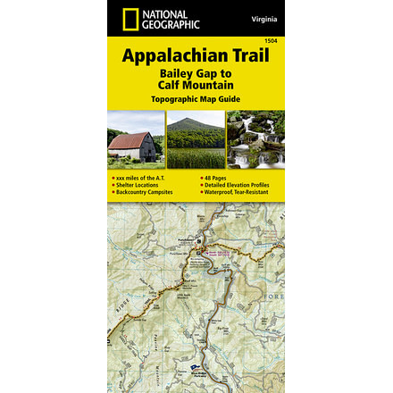
The Bailey Gap to Calf Mountain Topographic Map Guide makes a perfect traveling companion when traversing the central Virginia section of the Appalachian Trail (A.T.). The A.T. in central Virginia falls mostly within National Forest land, traveling through mature forests and over high mountain summits. The trail becomes more difficult as hikers go farther south, traversing the A.T.'s northernmost balds, past interesting rock formations, and over notable peaks, such as the Priest, McAfee Knob, and Dragon's Tooth.![]()
Features of Media Appalachian Trail, Bailey Gap to Calf Mountain:
- Other features found on this map include: Afee Knob, Apple Orchard Mountain, Appomattox, Bailey Gap Shelter, Black Horse Gap, Bobblets Gap Shelter, Brown Mtn Creek Shelter, Bryant Ridge Shelter, Calf Mountain, Calf Mtn Shelter, Campbell Shelter, Catawba Mtn Shelter, Cornelius Creek Shelter, Cove Mountain Shelter, Cow Camp Gap Shelter, Fullhardt Knob Shelter, George Washington National Forest, Harpers Creek Shelter, Humpback Mountain, Jefferson National Forest, Johns Hollow Shelter, Johns Spring Shelter, Lamberts Meadow Shelter, Laurel Creek Shelter, Lynchburg, Matts Creek Shelter, Maupin Field Shelter, Niday Shelter, Paul C. Wolfe Shelter, Pickle Branch Shelter, Pine Swamp Branch Shelter, Punchbowl Shelter, Reeds Gap, Rockfish Gap, Sarver Hollow Shelter, Seeley- Woodworth Shelter, The Priest, The Priest Shelter, Thunder Hill Shelter, Troutville, War Spur Shelter, Waynesboro, Wilson Creek Shelter.
Be the first to review this product
Media Appalachian Trail, Bailey Gap to Calf Mountain Unavailable & Discontinued Models
List of Unorderable Models
- Appalachian Trail, Bailey Gap to Calf Mountain , MPN: nag0441 , UPC: 749717915046 , Code: 2RQ-MAP-NAG0441-252645